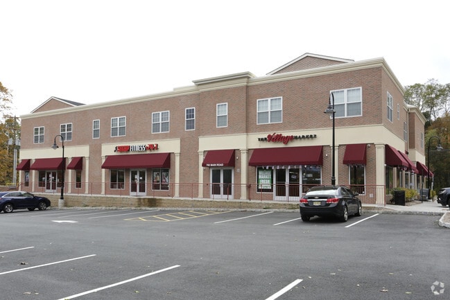
Property Record
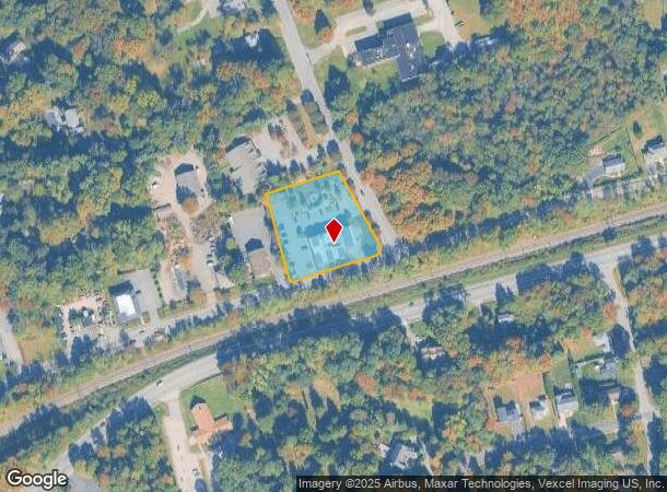
702 Main Rd, Towaco, NJ 07082


NEARBY LISTINGS FOR SALE OR LEASE
Property Detail
702 Main Rd
Newark, NJ-PA
La Sala Dev Inc
21-00040-0000-00030-3
INCL BLK 40 LOTS 30-03 & 30-04
Commercialnec
Morris
X
New Jersey
34027C0187F
30.3
2024
1.38 AC
2025
Parsippany
040804
Northern New Jersey
DEMOGRAPHICS near 702 Main Rd
1 Mile
3 Mile
5 Mile
2024 Total Population
3,245
31,533
120,409
2029 Population
3,240
31,497
120,004
Pop Growth 2024-2029
(0.15%)
(0.11%)
(0.34%)
Average Age
42
44
43
2024 Total Households
1,081
11,427
44,038
HH Growth 2024-2029
(0.19%)
(0.10%)
(0.42%)
Median Household Inc
$141,220
$133,378
$119,545
Avg Household Size
2.90
2.70
2.70
2024 Avg HH Vehicles
2.00
2.00
2.00
Median Home Value
$567,099
$557,719
$520,422
Median Year Built
1967
1974
1967
Nearby Places
Map Layers
Map Styles
 Street
 Aerial
- Restaurants
- Banks
- Shops
- Fitness
- Groceries
PUBLIC TRANSPORTATION
COMMUTER RAIL
Towaco (Montclair-Boonton Line - NJ Transit Commuter Rail (NJ Transit))
DRIVE
WALK
Distance
Towaco (Montclair-Boonton Line - NJ Transit Commuter Rail (NJ Transit))
1 min
7 min
0.4 mi
Lincoln Park (Montclair-Boonton Line - NJ Transit Commuter Rail (NJ Transit))
DRIVE
WALK
Distance
Lincoln Park (Montclair-Boonton Line - NJ Transit Commuter Rail (NJ Transit))
6 min
2.5 mi
AIRPORT
Newark Liberty International
DRIVE
WALK
Distance
Newark Liberty International
34 min
31.9 mi
LaGuardia
DRIVE
WALK
Distance
LaGuardia
49 min
35.5 mi
Freight Ports
Port Newark Container Terminal
DRIVE
WALK
Distance
Port Newark Container Terminal
1 min
19.0 mi
SALE & LEASE HISTORY
LISTING DATE
SALE/LEASE

Sep 25, 2016
For Lease
Jan 05, 2020
For Lease
Nearby Properties
Address
Land Use
TOTAL SIZE
Lot Size
Zoning
Address
Land Use
TOTAL SIZE
Lot Size
Zoning
21.99 AC
H
Address
Land Use
TOTAL SIZE
Lot Size
Zoning
49,701 SF
29.34 AC
GAR
Address
Land Use
TOTAL SIZE
Lot Size
Zoning
32.21 AC
R-15
Address
Land Use
TOTAL SIZE
Lot Size
Zoning
5,880 SF
17.46 AC
I
Address
Land Use
TOTAL SIZE
Lot Size
Zoning
140,560 SF
49.81 AC
R27A
Address
Land Use
TOTAL SIZE
Lot Size
Zoning
192,206 SF
7.73 AC
R-20
Address
Land Use
TOTAL SIZE
Lot Size
Zoning
41.71 AC
C-4
Address
Land Use
TOTAL SIZE
Lot Size
Zoning
97,631 SF
10.01 AC
B-2
Address
Land Use
TOTAL SIZE
Lot Size
Zoning
10.07 AC
R-15
Address
Land Use
TOTAL SIZE
Lot Size
Zoning
143,500 SF
14.73 AC
I
Address
Land Use
TOTAL SIZE
Lot Size
Zoning
Address
Land Use
TOTAL SIZE
Lot Size
Zoning
82,061 SF
12.39 AC
R-15
Address
Land Use
TOTAL SIZE
Lot Size
Zoning
634 SF
14.76 AC
H
Address
Land Use
TOTAL SIZE
Lot Size
Zoning
47,312 SF
12.34 AC
R-20
Address
Land Use
TOTAL SIZE
Lot Size
Zoning
101,685 SF
9.64 AC
I
Address
Land Use
TOTAL SIZE
Lot Size
Zoning
77,992 SF
9.87 AC
OB1
Address
Land Use
TOTAL SIZE
Lot Size
Zoning
57,880 SF
9.25 AC
B-2
Address
Land Use
TOTAL SIZE
Lot Size
Zoning
34.77 AC
R-15
Address
Land Use
TOTAL SIZE
Lot Size
Zoning
10.97 AC
R-15
Address
Land Use
TOTAL SIZE
Lot Size
Zoning
76,160 SF
12.83 AC
I2
Address
Land Use
TOTAL SIZE
Lot Size
Zoning
69,765 SF
23.74 AC
R-20
Address
Land Use
TOTAL SIZE
Lot Size
Zoning
114,540 SF
2.57 AC
OB2B
Address
Land Use
TOTAL SIZE
Lot Size
Zoning
25,266 SF
20.40 AC
R27A
Address
Land Use
TOTAL SIZE
Lot Size
Zoning
2.22 AC
OB-2
Address
Land Use
TOTAL SIZE
Lot Size
Zoning
62,431 SF
4.49 AC
I
Address
Land Use
TOTAL SIZE
Lot Size
Zoning
1,434 SF
6.10 AC
I
Address
Land Use
TOTAL SIZE
Lot Size
Zoning
35,226 SF
11.82 AC
R-15
Address
Land Use
TOTAL SIZE
Lot Size
Zoning
21,048 SF
2.24 AC
R-15
Address
Land Use
TOTAL SIZE
Lot Size
Zoning
54,944 SF
4.89 AC
I
Address
Land Use
TOTAL SIZE
Lot Size
Zoning
44,440 SF
1.42 AC
R40
The World's #1 Commercial Real Estate Marketplace
Connect with us
© 2025 CoStar Group
The information above has been obtained from sources believed reliable. While we do not doubt its accuracy we have not verified it and make no guarantee, warranty or representation about it. It is your responsibility to independently confirm its accuracy and completeness. Any projections, opinions, assumptions, or estimates used are for example only and do not represent the current or future performance of the property. The value of this transaction to you depends on tax and other factors which should be evaluated by your tax, financial, and legal advisors. You and your advisors should conduct a careful, independent investigation of the property to determine to your satisfaction the suitability of the property for your needs.